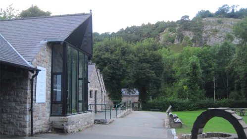
Loggerheads Country Park near Ruthin (CH7 5LH)


Horseshoe Pass, Llangollen
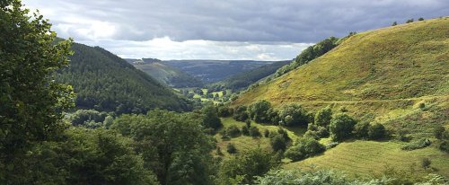
The Horseshoe Pass in Denbighshire, north-east Wales, separates Llantysilio Mountain to the west from Marilyn Cyrn-y-Brain to the east.
Offa's Dyke Path National Trail
Moel Fferna
Moel Fferna is a mountain in Denbighshire, Wales and forms part of the Berwyn range. It is the most northern outpost of the range. The summit is covered in deep heather and has a shelter cairn. A trig point used to mark the summit, but has since been destroyed.
Smithy Arms Bus Stop
| Day | Line | Route | Times |
|---|---|---|---|
| - Starting From 11/03/2019 | X11 | Dorchester - Sherborne - Yeovil(inbound) | 09:59, 11:17, 14:22, 18:04 |
| Monday To Friday - Starting From 11/03/2019 | X11 | Dorchester - Sherborne - Yeovil(inbound) | 07:29, 07:29, 16:35, 16:24 |
Jubilee Tower at Moel Femau

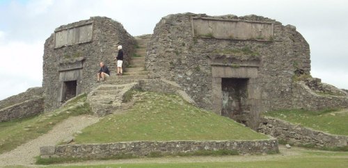
The impressive remains of The Jubilee Tower are found at the summit of Moel Famau and offer you another few feet in height to get a better view. These remains are at the highest point in the park at 1818ft (554m) and afford fantastic views.
Pontcysyllte Aqueduct
Corwen Memorial Park
Cynwyd Forest
Address: Cynwyd Forest, Denbighshire (Sir Ddinbych) (LL21 9EN)
Place type: Woodland Or Forest
Location: Grid Ref: SJ 0959 4285 • X/Y co-ords: 309599, 342858 • Lat/Long: 52.9754,-3.34773635
County/Unitary Authority: Denbighshire (Sir Ddinbych)
Region: Wales
Country: Wales
Height: 273.6m
OS Explorer map: 256: Wrexham / Wrecsam & Llangollen
Ruthin Play Park
Raven Inn, Llanarmon-yn-Ial
Overlooking the village green, this traditional country pub with guestrooms is 2.2 miles from Llyn Gweryd fishing lakes and 6.9 miles from Ruthin.
Points of Interest Map – Blobs
This custom-developed Site System module allows you to enter Points of Interest by lat/long coordinates, anywhere in the world, marked by 'blob' icons of selectable colour and size. To find the coordinates you need, navigate to the target area using Google Maps, right-click on the exact position and select 'What's here?'. A window will open up at the foot of the map, showing you the exact latitude and longitude of the selected spot. These two coordinates can then be used to create a marker exactly where you want it to show on your map.
The Main Map
The main map can be displayed within any Content Area on any page, and can also be set to display at full-page-width (as shown above) by selecting a Custom Class of 'extend-width'. You can configure an exact centre-position and zoom level, or you can let the module automatically centre its position and scale to suit the specific markers you have added. You can choose to use Google's default map colouring, or a muted colour palette (shown above) that makes it easier to see the markers. You will need a Google Maps API Key to use this module, but we can make this easy by running it through our developer's account (fees may apply if you exceed Google's very generous quota of free map impressions).
Overlays
If you wish to show a specific geographic area that is not otherwise included on Google Maps (such as the Clwydian Range and Dee Valley AONB boundary shown above), we can either find and convert the required coordinates from published data, or we can create a custom polygon for you (extra fees may apply). Using an overlay like this will prevent website visitors being able to select Google place markers such as business information, but the overlay itself can be made clickable (like this: landscapesforlife.org.uk/about-aonbs/aonbs ), or you can add your own clickable markers that can display additional information (as shown above).
Marker Types
You can create as many different marker types as you require, each with a configurable label, in one of three sizes (normal, small or large), and in any of nine colours (red, green, yellow, blue, orange, purple, gold, bronze, silver). Marker types can be configured to show in the filter list, or not. Note that once set, the scale of the markers remains consistent no matter how you zoom in or out of the map - this is intentional.
Markers
Markers can be added with nothing more that lat/long coordinates, the required marker-type, and a title. Click on the uppermost small yellow marker above to see what this looks like in practice. Alternatively you can add a link, pointing either to another page within your website, or to an external web-page. Click on the small blue marker at Llangollen to see how this looks. Or if you want to go the whole-hog and add pictures and text, there is no limit to the amount of content that you can add to a marker's information box. Click on the higher of the three red icons, or the large purple icon to its left to see examples of simple explanatory marker content. Other examples above include a bus timetable (large orange icon) and geographic data (bronze icon).
Marker Filtering
As can be seen in action above, any marker-type can be configured (or not) as a 'filter category', which then adds its title to a clickable list above the map, enabling the website visitor to clear the map of all markers other than the type they are interested in. Bear in mind though, that whilst there is no limit to the number of markers and amount of content that you can assign to each marker, all of this data needs to be downloaded to the visitor's browser before they start using the map, so the more content you add, the slower the page will take to load. Whilst this may be insignificant for someone at home on a high-speed fibre internet connection, a phone user in the middle of Ruralshire might not be willing to wait five minutes to see your comprehensive map full of many dozens of points of interest, all with lovely pictures and interesting text!